
The Alaska trip
When Solstice left Anacortes at 5:30 a.m. on June 21, 2006, with John's parents, Tom and Audrey, on board with us, we hoped to reach Skagway and get back to Juneau by July 9th in time to pick up John's Aunt Ginger. We had roughly plotted it out as about 920 nautical miles to Juneau, and at an average speed of six knots, it seemed possible if we put in long days. The map shows our approximate route. We allowed five to six weeks for the whole trip. ("A knot is pretty much like a mile per hour, but more expensive." — P. J. O'Rourke)
British Columbia 
Our first day was great. We cleared Canadian customs at Bedwell Harbour in less than an hour and made it to Nanaimo in time to do our provisioning and celebrate our 20th wedding anniversary at a nice restaurant at the marina. The weather was beautiful, and we were startled by the beauty of Nanaimo's setting. We regretted that we couldn't linger and visit the museum there, but thought we might be able to visit it on the return trip.
Along Vancouver Island
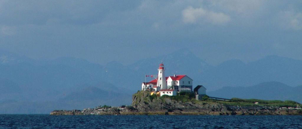
We left Nanaimo early the next day, again around 5:30. That became the usual departure time on our northbound voyage, and we often sailed until sundown. We knew we would reach Seymour Narrows that day, but we weren't sure the current would be running in our favor when we got there. We already loved British Columbia. Now those BC license plates we'd seen up and down I-5 made sense. It really is beautiful … rugged, snow-capped mountains in the background and picturesque, red-roofed lighthouses on many of the islands we passed.
At Campbell River we topped off our fuel tanks. This was the friendliest and most helpful fuel dock we'd visited so far. John also wanted to tap into local knowledge about dealing with Seymour Narrows, which was now just around the corner. The old-timer at the dock assured us that we would hit it just right if we left immediately and even gave us a photocopy of the current table. So we set off.
The current was pretty strong, but it was in our favor, so we enjoyed it. John spotted a pair of orcas fishing just south of the Narrows, and we were watching them when a northbound tug and barge hailed us and asked to go ahead of us. That was fine with us since we didn't want them to overtake us in the narrow passage. It was a fast and exciting piece of water. At one point our speed hit 14 kts., and the steering got a little mushy, but the only traffic was the tug ahead of us, and it was all good.
We anchored that night in Otter Cove, just south of Rock Bay Provincial Marine Park. There we saw a black bear — the only one of the entire trip — and a jellyfish — the first of many. Of course, we'd been seeing bald eagles all along the way. It was a great day for wildlife. Tom and John were re-hashing the day's adventures when Tom noticed that the current tables were for July, not June! All's well that ends well, but we learned to pay closer attention after that. I had tides and currents on my Palm Pilot, and from then on, I double-checked with it.
The next day we motored west in Johnstone Strait. The strait seemed more like a lazy river than a body of saltwater, and it was a leisurely, albeit long, day. The weather remained beautiful. In fact, it stayed beautiful until after the Fourth of July. There was very little boat traffic, and it felt like we were really adventuring. Our only concern was that the alternator on the engine had stopped working. We had the generator, though, so we still had power, and we didn't need the alternator to make hot water as long as we were motoring. That day we made it all the way to Beaver Harbour on the south side of Queen Charlotte Strait, just east of Port Hardy. Of course, by the time we got there, it was almost dark, so we didn't see much.
Central and Northern BC coast
Throughout the trip we ignored statistics about distance. We didn't figure out our miles-per-day. We did calculate how long we thought it would take to get to our next anchorage or marina, but we didn't figure that out until afternoon when we were picking a place for the night. In my memory, though, the leg from Otter Cove to Bear Harbour was one of our longest. It was followed by another long one from Bear Harbour to Shearwater. We didn't get into Shearwater until about 8:30 p.m. We made up for two long days with a relatively short leg from Shearwater to Butedale.
Butedale is an old cannery site with a beautiful waterfall and a colorful caretaker. John and Tom went exploring, and we have a whole page of photos from that stay. It was fun at the time, but we discovered the next day that we'd picked up a couple of mice while we were tied to that rickety dock. Tom and John got rid of them, though, after they bought mousetraps at Prince Rupert.
The day we left Butedale the big excitement (besides the mice) was that we met another Sceptre 41. This one was headed south from Prince Rupert, taking advantage of the northerlies that were in our face. They spotted us first and hailed us. I'm sorry I didn't make a note of their name. We were watching them out of sight when we noticed a humpback cavorting. There's really no other word for the leaping and splashing that was going on. The other Sceptre had a great view of it; we were really too far away.
As the other Sceptre disappeared from view, we entered Grenville Channel, another saltwater river. The beautiful views there were tempered by the 20+ knot winds in our face. It didn't help that the current switched about midway and started running against us. Our average six-knots became barely two. Although we carry lots of fuel, we don't enjoy wasting it under circumstances like that. This was where we decided that we would try never to plan another sail with a fixed schedule again. From now on, we like weeks of padding in our schedules.
We anchored in a beautiful cove at Kumealon Island that night instead of docking in Prince Rupert as we had hoped, but we did make it to Prince Rupert the next day. We really enjoyed PR. It's the end of the trans-Canadian highway and Bill Murray's home town. We had the alternator replaced there.
We enjoyed picking our way through the well-marked — and very busy — passage from Prince Rupert to Metlakatla and then through the less-well marked North Shortcut. At one point when we thought we were clear of the shortcut, we headed more northerly, only to find the bottom suddenly coming up on us. We immediately turned around, rechecked the chart, and found that we needed to backtrack a way to get back to the course south and west of the shoal. On our last night in BC we anchored in Brundige Inlet on Dundas Island.
Alaska 
On June 29th we crossed Dixon Entrance and entered Alaska. We made it to Thomas Basin in Ketchikan by early afternoon, and Audrey and I did laundry while John and Tom went to reprovision. Then we went exploring and looking for a restaurant where we could have dinner ashore.
Ketchikan was filled with cruise ships. When we arrived, there were two at the docks and two more at anchor. A fifth left as we were arriving. That's apparently fairly normal for Ketchikan in the summer. As a result, downtown is filled with t-shirt, souvenir, and jewelry shops, but there are few restaurants. Tom and Audrey, who have gone on several cruises, explained that cruise-ship passengers rarely waste money on restaurants in port since they've already paid for their meals on board.
We left early the next morning and weren't sorry to see the last of Ketchikan for awhile. Our route took us through Clarence Strait and Kashevarof Passage to Sumner Strait. So far, we weren't very impressed with Alaska after the beauty of BC.
No engine and no wind
We planned to anchor at Deception Point Cove and head north through Wrangell Narrows the next day. However, at the northwest corner of Zarembo Island, the engine died. We thought that we had miscalculated the fuel before changing tanks, and John and Tom worked hard to prime the fuel pump. (John had done this before in rough water off Noyo River. At least the water was calm here.) But we just couldn't get the engine to start. There was nothing to do but hoist the sails.
Sails without wind are ineffective, though. There was only the faintest breeze that evening, and it was variable. As we drifted back and forth between Level Island and Zarembo, we were lucky to catch a puff just in time to avoid running aground. John called a pan-pan into the Coast Guard because we were drifting, powerless, in a traffic channel. Finally, sometime after dark the wind came up enough to make some way, and I went to bed while John sailed toward Wrangell.
Wrangell
Wrangell wasn't on our original itinerary, but it was the closest town. The next morning I took over that the helm while John napped and the wind died. It took hours of tacking back and forth to clear the channel between Zarembo and Vank Islands. We made a little progress on each tack, only to lose it to the current. Finally, whether due to skill at the helm or, more likely, a change in the current, we got clear of the islands and could see Wrangell in the distance. To our dismay, however, we had about a mile of light breeze before we could see that the water changed to glass about three miles from Wrangell. John called the harbor master to find out about a tow, and search-and-rescue brought us into the harbor a couple of hours later.
Wrangell was a delight. Good thing, too, because it was Fourth of July weekend, and we were stuck there. The search-and-rescue guys recommended a diesel mechanic, and he agreed to stop by after he finished a tour he was guiding. There wasn't a lot that could be done until after the holiday, so we were forced to relax and explore Wrangell. John got some great photos to show for it, and we all enjoyed a real small-town Fourth of July holiday.
Clay Hammer, Brown Bear Diesel, is the only diesel mechanic in town, as far as we know. And that's only one of his several jobs. He's also one of the nicest people you could hope to meet and related to half of the town of Wrangell. The engine had several things wrong: something about a regulator and the fuel pump and the starter. Clay fixed something, patched something else together, and replaced the starter. In order to do all that, he chased parts all over town on our behalf.
Beyond Wrangell
We finally left Wrangell on July 6th. The Wrangell Narrows were an adventure, and near the south end we kissed a buoy that got in our blind spot. After that, we were fine and made good time. When we emerged into Frederick Sound, we saw the first of the spectacular views Southeast Alaska is famous for. Due to our engine problems, we had dropped Skagway from our itinerary, so we lingered and anchored out at Portage Bay and Cannery Cove at Admiralty Island on our way to Juneau. Stephens Passage and Frederick Sound offered gorgeous views and numerous whale sightings.
The weather remained fair until we got to Juneau. Our mast is too tall to clear the bridge in Juneau, so we used the marina on Douglas Island. It's a fair distance from Juneau, but John's folks rented a car, so we got to explore anyway. After we picked up Aunt Ginger at the airport, we went to Mendenhall Glacier (where John captured wildflowers with his camera) and Alaska Brewing, ending the day with a trip on the tram up the mountain for dinner. We couldn't see much on the mountain due to the clouds, but John and Tom enjoyed a hike on the nature trail.
We had a great trip back to Ketchikan with Aunt Ginger. The weather cleared, and many of John's photos are from this leg of the trip: Taku Harbor,Tracy Arm with its glaciers and icebergs, and many more whales on our way to Fanshaw Bay. We took an alternate route after Wrangell Narrows and followed Zimovia Strait and Seward Passage around Wrangell Island. We wanted to see the bears at Anan Bay Bear Observatory, but found out after we got there that we needed reservations.
Ketchikan
Ketchikan was more fun on our way south. This time we stayed at Bar Harbor north of town, and we found several restaurants we enjoyed, one very near the marina. Tom and Audrey again rented a car, and we explored the whole road north and south of town. This gave us a chance to see more of Ketchikan's famous totem poles and for John and Tom to explore an amazing park north of town. We stayed put at the marina while a front passed through, and the day we left (July 21st) we ran across a whole pod of orcas near Cape Fox.
Back to BC
Although we retraced our route through BC heading south, it seemed a lot different. Queen Charlotte Sound was bigger, and Audrey felt it despite the Relief Band that kept seasickness at bay the rest of the trip. Johnstone Strait lived up to its reputation of rough water and high winds. We did Seymour Narrows properly, at slack with the rest of the small boats and one cruise ship.
The return up Johnstone Strait was the only time we were really able to sail, and that ended expensively when the winds suddenly increased from 12 to 30 knots. John and Tom were flying the Genoa jib at the time, and John says it was as if someone flipped a switch. As they were trying to furl the jib, the sheet got away and wrapped around the forestay. Next thing we knew the jib was shredded. We made it to an anchorage at Humpback Bay, but it was a tight space on a windy night. We set both the usual anchor alarm and a radar-based alarm.
Impressions
We could have spent twice as much time up north without getting tired of the incredible beauty. There are still places we'd like to see if we could go back. For example, we didn't make it all the way to Skagway, we've heard good things about Sitka, Misty Fiords National Monument sounds intriguing, and now we know we need reservations to see the bears at Anan Bay Bear Observatory.
The disappointment of the trip was our inability to catch fish. John, Tom, and Audrey got fishing licenses in Wrangell, and we were pretty excited by the abundance of butter sole there — until we tried eating them. The taste was OK, but the texture made them unpalatable. They kept trying, but only caught more of the same, plus sculpin and other junk fish. Fortunately, we did better with the crab and had several tasty Dungeness. Thanks to a generous Canadian in Wrangell, we also enjoyed fresh halibut and introduced Tom to fish tacos.
Our favorite restaurant of the trip was Patti Finn's Seafood and Lighthouse Restaurant at Campbell River. It's on floats at the marina between the dock and shore. They don't advertise, but you should definitely have reservations if you want to eat there. We were early and lucked out. People who walked up after us were turned away. Fresh local seafood is prepared simply there — no batter — and you can talk with the fisherman himself. Patti Finn's supplied the fresh fish we didn't catch ourselves. The combo dinners are awesome.
According to our log, we made the trip from Campbell River back to Port Townsend in one day. But that just shows that we weren't very good about keeping the log current. We actually spent one night at Clam Bay in the Gulf Islands. After the relative wilderness of Alaska and Central BC, the Gulf and San Juan Islands seemed crowded to us. Friday Harbor, where we cleared into the US, was a zoo. Of course, it was a weekend in the middle of the summer. The trip officially ended when John's sister, Jenice, picked up Tom and Audrey in Port Townsend on July 30th.